
PGRSC National Focal Points Network
PGRSC Focal Points
Pacific Focal Points map
Click a country marker to view the active Focal Point(s) for that country.

In order to regionalise our annual Pacific Islands GIS & RS Conference, the Council moved forth to select/nominate national focal points. The focal points are responsible for the following activities:
- Collect and summarise ideas on improving and creating a more inclusive Pacific Islands GIS & RS Conference
- Promote the Conference by receiving the latest news
- Follow up national presentations and assist in facilitation
- Distribute spatial and non spatial data.
- Distribute the GIS&RS Newsletter
Find a list below of the National Focal Points with their contact information. If there are any concerns, or if you would like to represent your country as a focal contact please feel free to email pgrsc@pgrsc.com
 American Samoa
 Australia
 Cook Islands
 Fiji
Fiji
 French Polynesia
 Guam
Guam

Maria Kottermair
Membership: Individual member
Maria Kottermair is a certified Geographic Information Systems Professional (GISP) with over 20 years of work experience in Micronesia. She is currently pursuing a PhD at the University of Queensland, Australia, studying shoreline changes of atoll islands.
 Kiribati
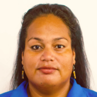
Catherine Paul
Membership: Individual member
I am Catherine Paul, a Principal Mineral Officer in Kiribati, passionate about applying GIS and remote sensing to coastal monitoring and sustainable resource management.
Tiaotin Enari
Membership: Institutional member
 Marshall Islands
Benedict Yamamura
Membership: Individual member
Mark Stege
Membership: Individual member
 Micronesia
Luke Carlos
Membership: Individual member
I am a geospatial science student with a focus on developing software relevant to GIS/Remote Sensing. I am from the Federated States of Micronesia, and I enjoy history and gaming.
 Nauru
Nauru
 New Caledonia

Damien Buisson
Membership: Institutional member
I work for the IT Department of the New Caledonia Government and I am the head of the GIS and remote sensing desk. I am also the main facilitator for the Gis Club in New Caledonia Participating in the PGRSC is crucial for advancing geospatial collaboration and ensuring sustainable, data-driven decision-making in the pacific. It strengthens regional coordination and promotes innovative solutions for environmental and territorial challenges.
 New Zealand
Angela Manchester
Membership: Individual member
 Niue
Niue
 Northern Mariana Islands

Bradley Eichelberger
Membership: Institutional member
Mr. Eichelberger has over 20 years of experience integrating geospatial science and analysis with natural resources conservation and management. He has served as Board Member and Chair for the Pacific Islands GIS and Remote Sensing Council, Core Team Member of the Pacific Regional Invasive Species and Climate Change Management Network, Chief Geographic Information Officer with the CNMI Division of Fish and Wildlife, GIS Analyst for the Natural Capital Project at Standford University, and Ecologist for the Pennsylvania Heritage Program. He also develops databases, data collection applications, and synchronization processes using Python programming as well as routinely conducts statistical analyses using R.
 Palau
Palau
 Papua New Guinea
Arnold Lakamanga
Membership: Individual member
 Pitcairn Islands
 Samoa
Samoa
Tooa Brown
Membership: Individual member
 Solomon Islands
Joy Katrina Papao
Membership: Individual member
The focal point for the Solomon Islands and currently supporting NDMO on DM/DRR activities in the country.
Tokelau
 Tonga
Tonga
Halalilika Etika
Membership: Individual member
 Tuvalu
Dolores Leneuoti
Membership: Individual member
I am from the small island nation of Tuvalu. I work as a Land Management Officer for the Lands & Survey Department under the Ministry of Natural Resources Development
 United States
Clare Mamura
Membership: Institutional member
 Vanuatu
Johnie Tarry Nimau
Membership: Individual member
 Wallis and Futuna
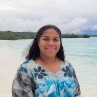
Hélène PATEL
Membership: Individual member
Head of the Heritage & GIS Section within the Studies and Heritage Division of the Public Works Department.