PGRSC Overview
The Pacific GIS and Remote Sensing Council (PGRSC) was established to oversee the activities of the Pacific Islands Annual GIS & RS User Conference and in response to the need to outsource the conference administration and procurement processes outside of SPC. The Council’s board members, constitution and all institutional arrangements were achieved within a limited time frame as it was paramount for the council to open a bank account that will accommodate all funds directed towards the logistics and activities of the GIS & RS User Conference.
Objectives
The constitution states 5 objectives of the council:

To promote the development of GIS and Remote Sensing (RS) data, technologies, methods and services for the pacific region;
To enable collaboration and share lessons learnt across regional agencies and commercial parties;
To discuss and establish methods in building adaptation for the Pacific environment for solutions working already well outside the region;
To manage the distribution, publication and awareness of conference outcomes;
To establish robust links with other GIS, RS and scientific bodies regionally and globally.
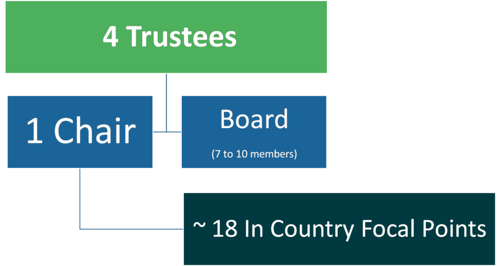
Council Structure